Albemarle Sound and Pasquotank River

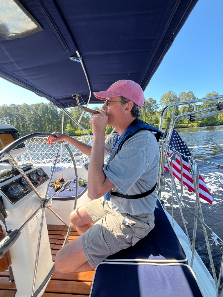
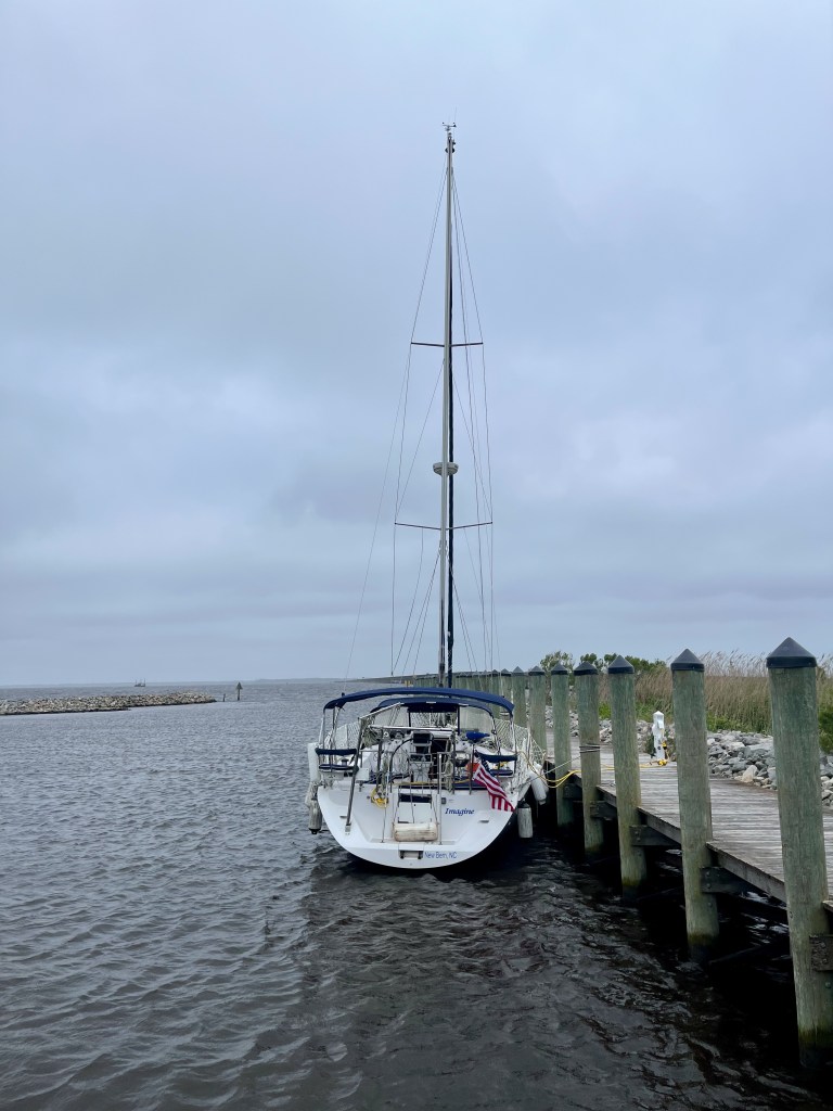
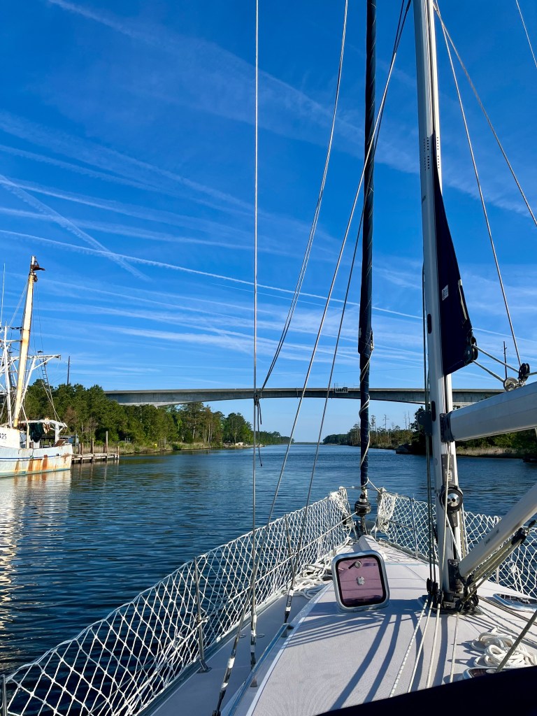
This morning we shoved off the marina dock at 7:30. Winds were still up, but much calmer than yesterday.

Morning at the marina

We had one little snag as we were departing, and I am still replaying the potential horror of it in my mind. We had our bow line wrapped too many times around the piling at the dock, and when I let go of the bitter end (the end of the rope) to pull it onboard and release us for departure, it resisted sliding off. Charro already had us in gear at that point, moving us forward. Thank God that thing unraveled at the last minute. There was a large yacht docked in front of us. Had the line not let go, our stern would have swung around and we would have hit their boat. I truly believe you learn the most through mistakes. That is one I do not intend for us to make again!

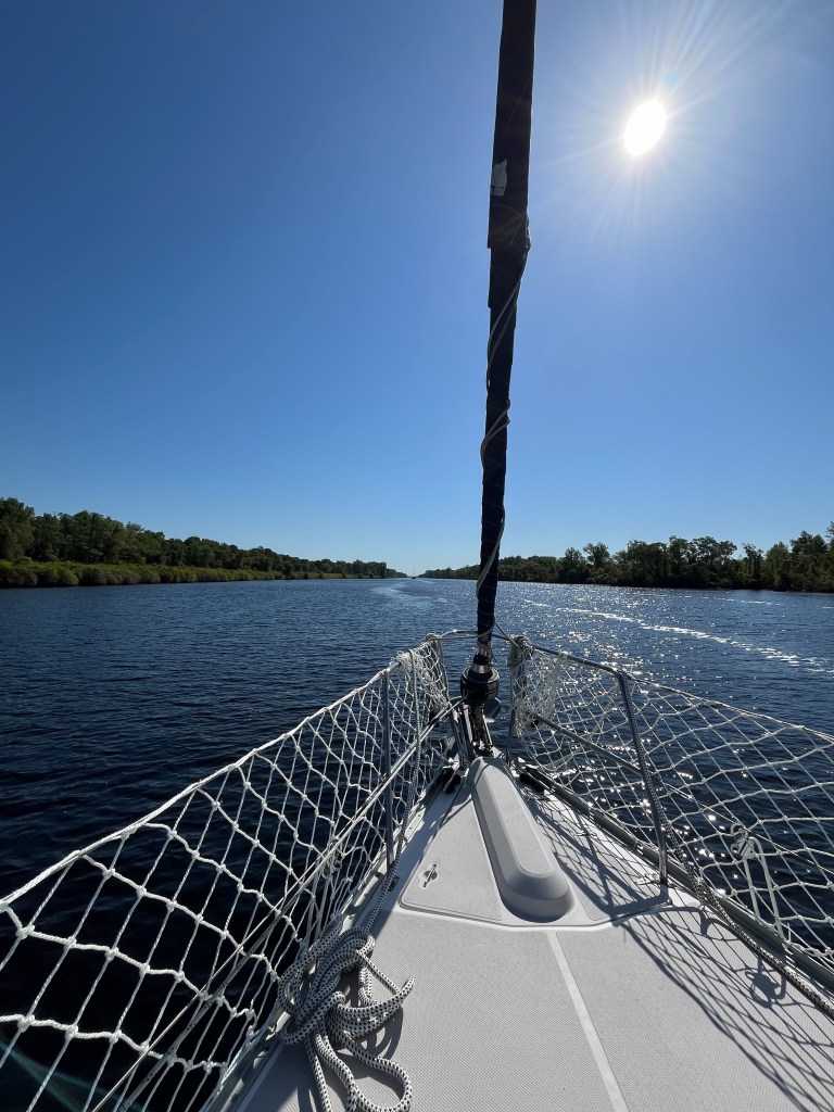
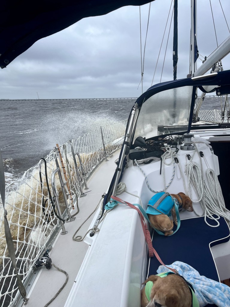
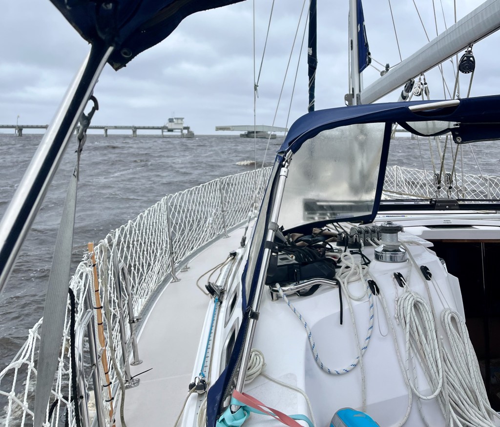
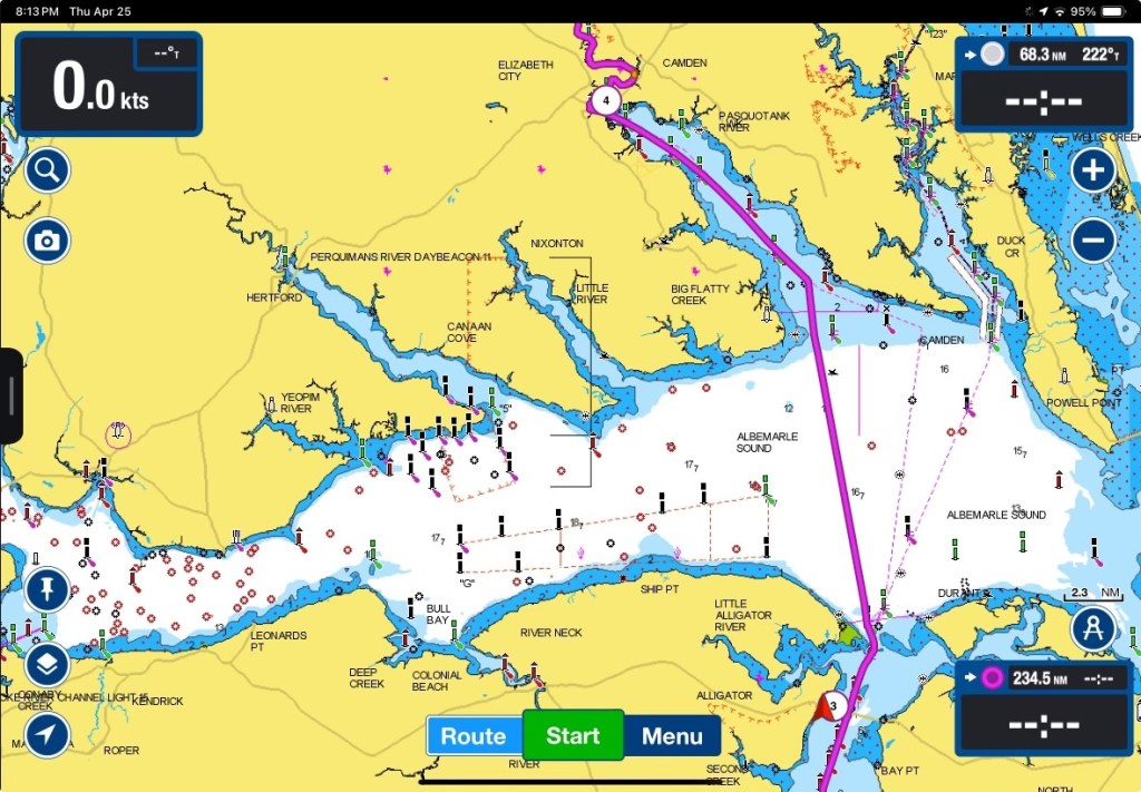
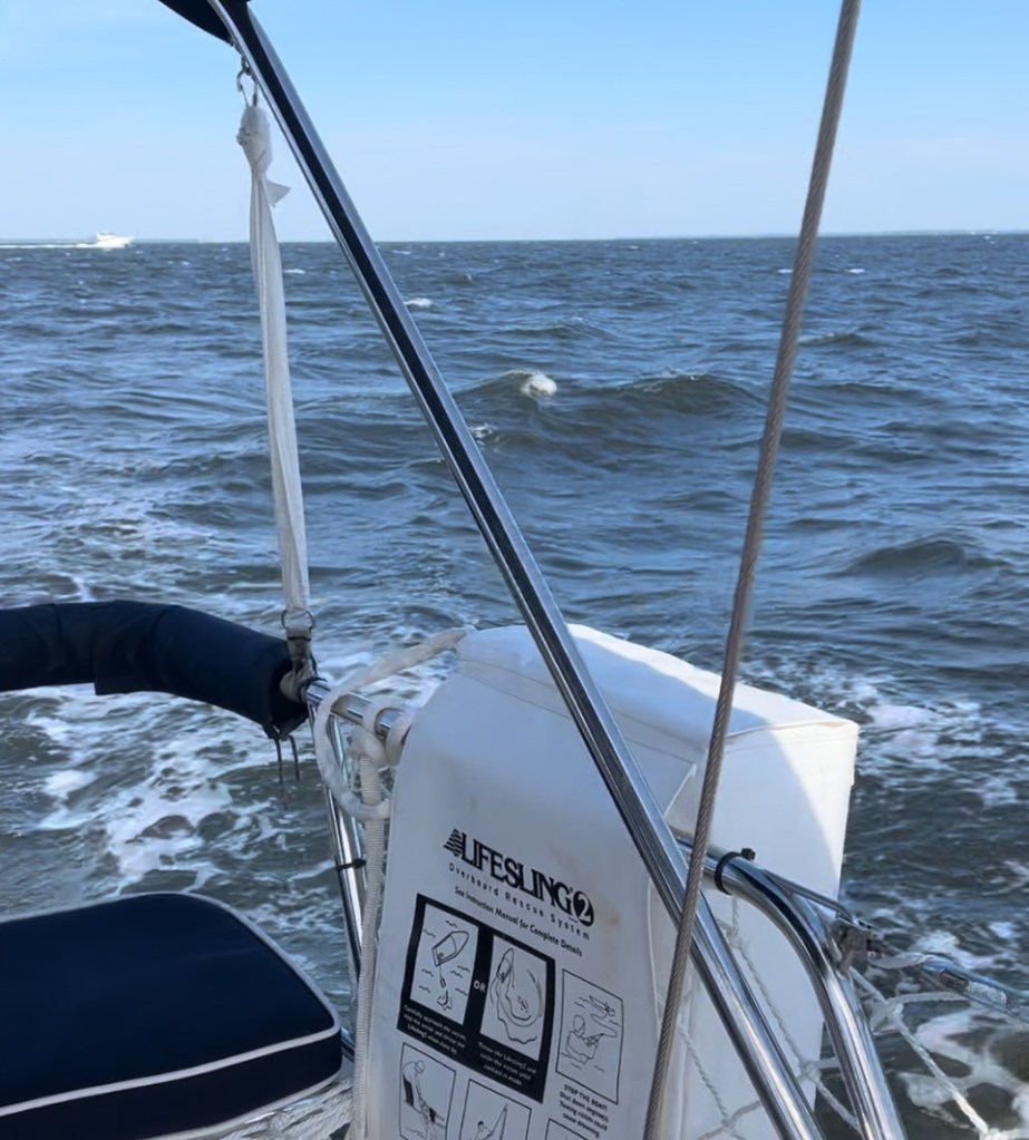
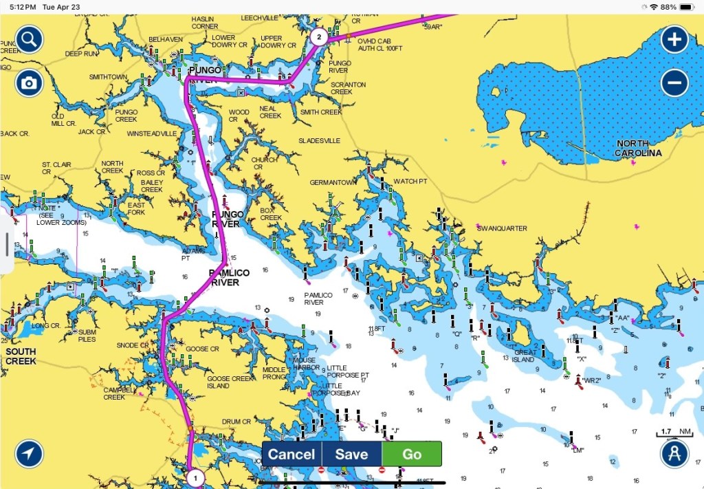
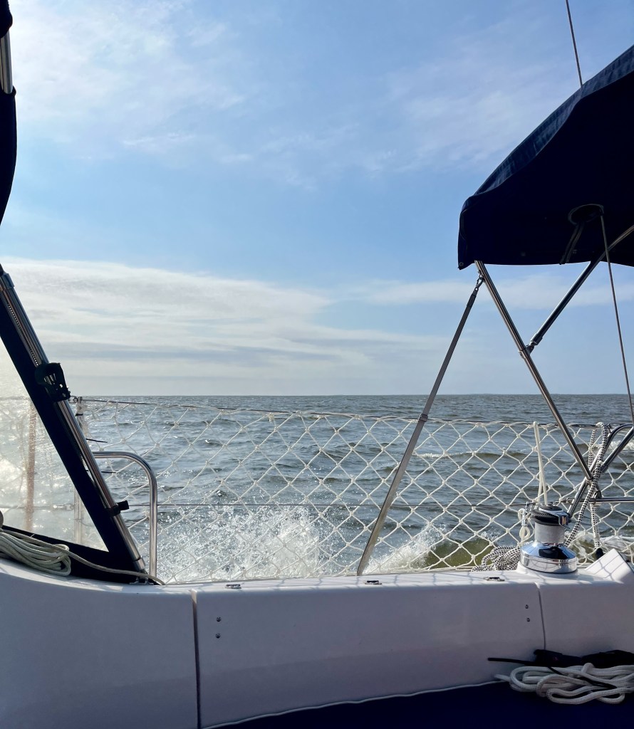
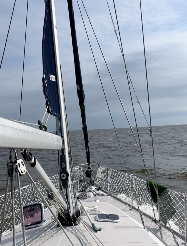
From the marina to the end of the Alligator River, it was a quick three miles or so, and then we entered into the Albemarle Sound. Winds today were blowing 10-15 knots with waves at 2 ft. About half way across the 11 mile run, it got very rolly. The waves were hitting us on the beam, which rolled us a fair amount from side to side. Maybe my perspective has changed since the second day of our journey, but it didn’t unnerve me nearly as much as the day we crossed the Pamlico and Pungo Rivers. We managed between 6-7 knots of speed and made it across the Sound in about 2 hrs. (I forgot to jot down the exact time).

Crossing the Albemarle Sound
On the Albemarle Sound

From the Albemarle Sound, we entered into the Pasquotank River. By that point the wind was on our stern, which helped push us along and minimized the boat’s motion.

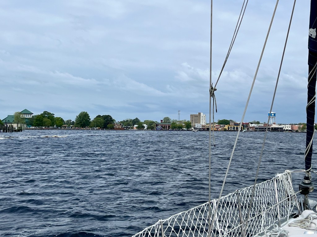
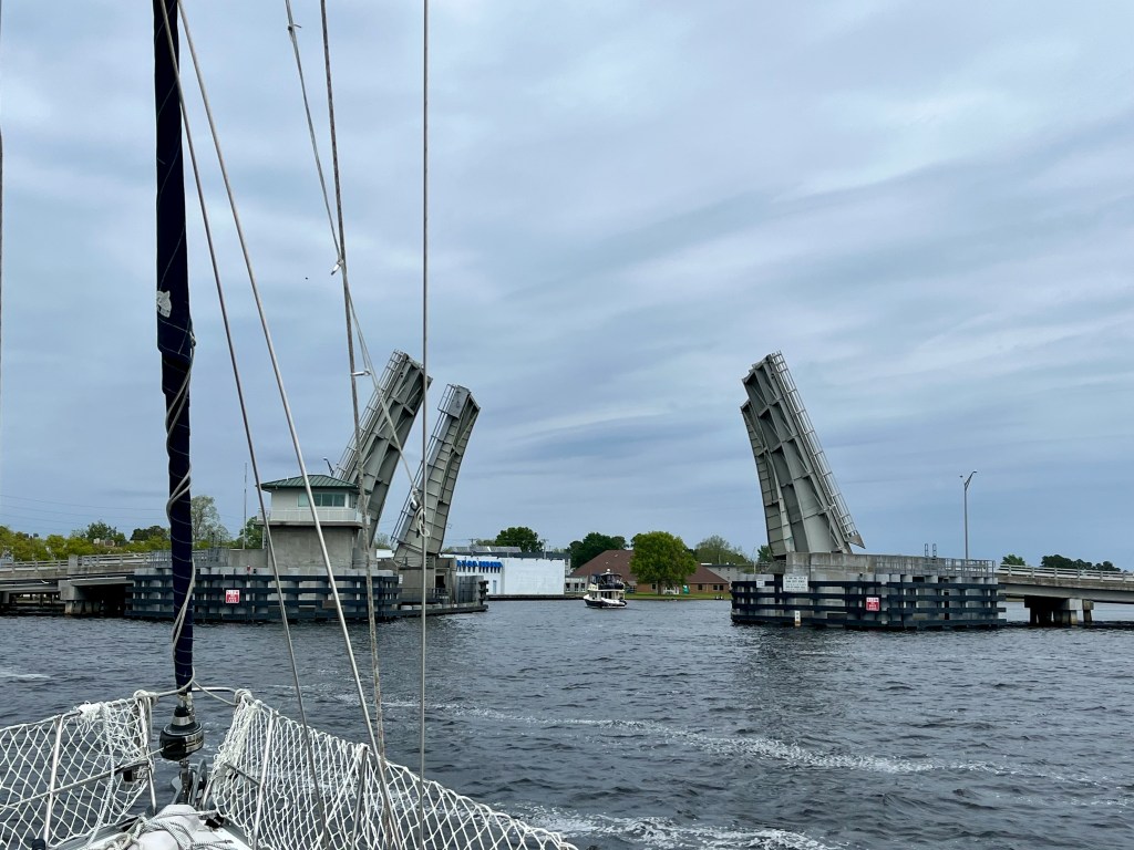
Roughly two hours later, we arrived in Elizabeth City, where almost immediately, we came to the Elizabeth City Bridge (a drawbridge). We hailed the bridge tender for an opening. There was one boat in front of us and the tender was waiting on a third to arrive behind us. So for maybe ten minutes or so, we circled and held until we received the all-clear to motor through. I couldn’t help but sing the chorus, “When you get caught between the moon and New York City” while we waited.

Arriving in Elizabeth City, NC
Getting ready to approach the Elizabeth City Bridge

There was one more bridge to cross before we arrived at our spot for the night – the Norfolk Southern Railroad Swing Bridge. It usually remains open, and today it was. Although you really couldn’t tell if it was open or not until you were practically at the darn gate! Regardless, I had my air horn ready to sound the signal request if needed.

Norfolk Southern Railroad Swing Bridge
Pasquotank River

A short ride later (around 1:15), we arrived at our chosen anchorage. The entirety of our journey today was just shy of 6 hrs. Hard to believe, but in total, we have already traversed 137 nautical miles! That means we are past the halfway point with 98 left to go! Barring unforeseen weather or circumstances, we should arrive at our home marina in Topping, VA on Tuesday.

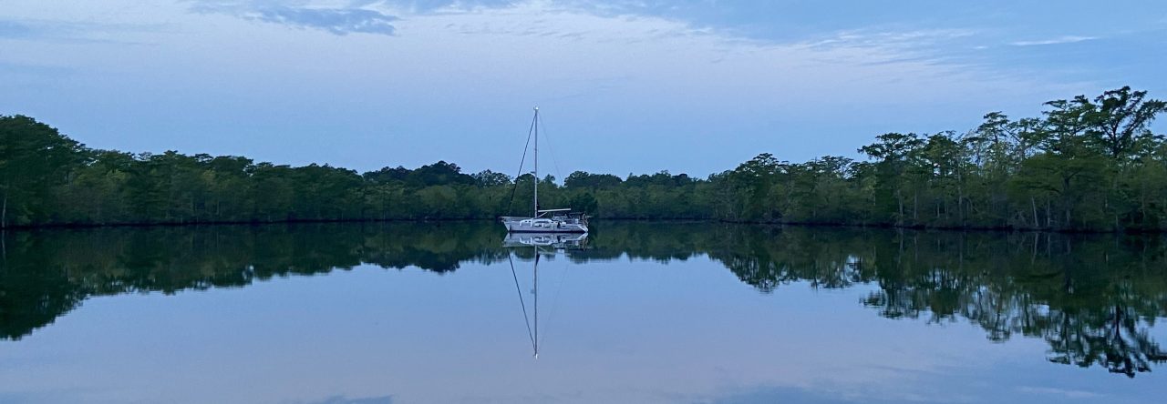
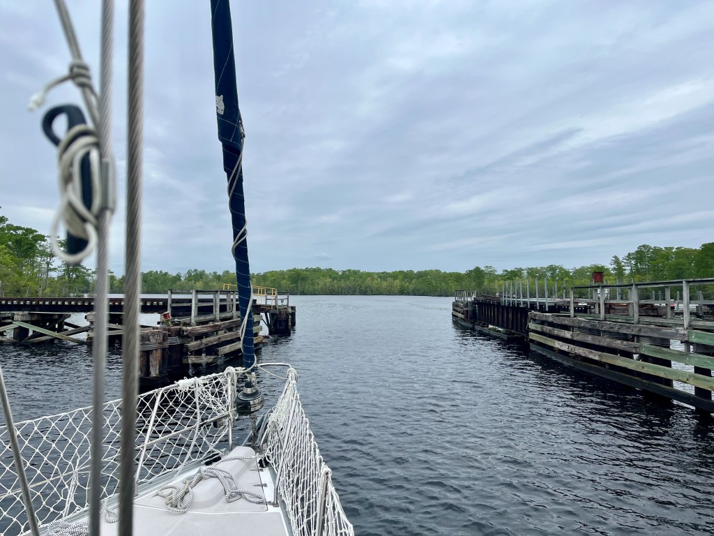
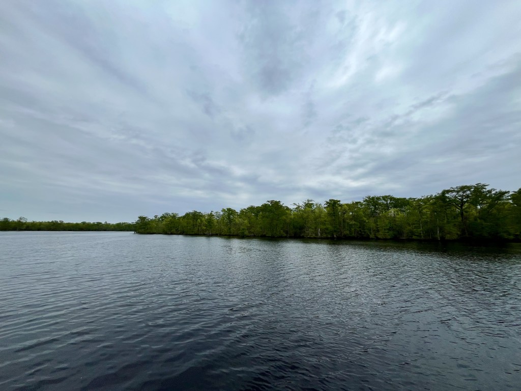
We are currently stopped for the night in a truly beautiful, scenic, peaceful spot on the Pasquotank River, just outside of the ICW next to Goat Island. This is my absolute favorite spot so far! Since we arrived, we have seen three fisherman in johnboats and only two other ICW travelers. We are hopeful that the lack of transiters means we won’t have much competition to tie up at the free dock tomorrow.

At anchor on the Pasquotank River

We appreciate all who are keeping up with our journey. Thank you for following along!

Sunday’s Goal: 29 nautical miles

Our plan for tomorrow is to depart super duper early (6:00 ish) to take advantage of the first lock opening time of 8:30 am (South Mills Lock). After locking, we will cross through South Mills Bridge and then make the 4 hour journey through the scenic Dismal Swamp Canal. Our plan is to tie up at the bulkhead at the end of the canal, just before Deep Creek Lock.

Fair winds,

Wendy

It’s a Rest Day

When we awoke this morning the sun was shining but the wind was still blowing like crazy. We saw that the Small Craft Advisory had been extended to late morning, so we decided to spend one more night here at the marina instead of trying to run the 11 nautical miles of the Albemarle Sound. I’m glad.

It has been a welcome day of rest. Charro is especially sore and worn out after yesterday’s big high seas adventure. I am not particularly sore, just a bit knackered.

We began the day with a delicious hot breakfast at the marina shop. Then I did some vacuuming and tidying up. And because we didn’t eat enough fried food yesterday, we went back to the shop and ordered fried shrimp for lunch. We are now streaming our favorite shows, drinking Caymen Jack margaritas, and cuddling with the pups.

We have to depart the marina tomorrow morning because they have a bunch of people with reservations coming in. Right now, tomorrow’s forecast for the Albemarle Sound is winds out of the east at 10-15 knots and waves 1-2 ft. Sounds like it is going to be an exciting crossing, but it should be calmer than it would have been had we tried to cross today. We still plan to overnight in Elizabeth City.

Fun fact: On average we are using 7 gallons of water per day (includes 2 quick showers each, shaving, teeth brushing, quick hand washings, filling the dog’s water bowl, and only the quickest of utensil rinses). We are fortunate to be able to top up with water while here at the marina, but even without it, we calculated that we still had 15 days left of what we brought with us.

Fun fact: For kicks, we timed each other’s shower speed. We only clocked it when the water was turned on, not during the soap up. Charro uses 65 seconds of water to wet and rinse. I came in a little worse, but only by 30 more seconds. What can I say. I’m a woman and I use more products. 🙂

Sunrise on the Alligator River

I will update again tomorrow.

Fair winds,

Wendy

Oh What a Day!

We wanted an adventure. I’d say we are having one!

We departed our lovely anchor spot at 8:30 this morning after a quiet, restful night. The plan was to just run the scenic four-hour Alligator River-Pungo River Canal and then (due to the Small Craft Advisory) anchor at the south end of the Alligator River. This plan is an amendment to my previous post.

We had consulted our charts and picked out a couple of depth-appropriate options to anchor at tonight. However, when we actually arrived at the chosen areas, it was nothing like we expected. All of the potential spots were wildly exposed to the raging northeast winds and appeared to offer no real protection at all. With nowhere sensible to anchor, we chose to (wisely? unwisely?) press on and make the river crossing. We have heard a lot about how rough the Alligator River can be, and today we found out how true that is.

In the beautiful and calm Alligator River-Pungo River Canal
How it started – a lovely day for a ride
Cuddling Ruby on the canal
Lauriston looking for alligators on the canal

Immediately upon entering the river, and no longer in the protection of the canal, the winds kicked up hard and it got quite cold. Waters became rough and choppy. We motored pretty much dead into the wind. For nearly four hours, WindLass surfed! Instead of the sideways rolling we experienced yesterday, today’s ride was more of an up and down, bucking broncho sort of experience. We got splashed a few times. But our girl held up beautifully. Charro is our helmsman on this trip and he and WindLass do a great job. My job on this journey is to serve as documentarian, help keep a watch, consult the charts, assist with lines, serve snacks, and soothe the pups.

How it ended – a wild ride!

As we got closer to the end of the Alligator River, we were still not feeling secure or confident that we would find safe harbor for the night. There really don’t seem to be many (if any) good, protected areas on the Alligator River. It kind of stinks!

I ended up calling the Alligator River Marina to find out if they would be able to accommodate us. Everything we have read says the draft going in is very shallow (barely what we can clear, which is 4’8″). We were a little desperate at that point, though, so we decided to go for it.

First, though, we had to pass through the Alligator River Bridge, which lies just outside of the marina. It is a swing bridge and is opened on demand (except in winds that exceed 34 knots). About a half mile out, we hailed the bridge tender on our VHF and requested an opening. I still can’t get over the fact that traffic had to stop just for US! 🙂

The Alligator River Bridge opening so we could pass

Just north of the bridge, the real fun began! Because the waves were so rough, Charro had to go a bit past the marina and then make a turn toward the southwest to make his approach. I guess it’s a bit like what a pilot must have to do when landing. That was the most intense moment, as we heeled a good way over a few times all while riding the waves. It was a bit scary, I must admit.

We arrived at the marina at about 4:30 pm. A very sweet fella named Ian was waiting for us on the docks as we motored in, and he guided us to where we should land our vessel. He helped to secure our lines, which was a tremendous comfort, as this was the first time we have ever docked in big winds. Thank God for Ian.

The Alligator River Marina is nothing if not delightful. It is a tiny, country marina that is also a gas station/convenience store and gift shop. Here we have shore power, access to water, wi-fi, and I was able to do a load of laundry. All of the staff are so sweet. They even have a short-order cook that made us the BEST fried chicken and fried okra! The dogs, too, were extremely relieved to get off of the boat and finally do some proper business. 😀

I am so thankful we are here. Even tied up securely against the dock, the wind is raging at a sustained 25 knots. But I will sleep well tonight knowing we are safe.

Docked safely for the night at Alligator River Marina (the name says Imagine but she’s now WindLass – we haven’t had the lettering changed yet); the Alligator River is in the distance

In hindsight, it probably would have been prudent to spend one more night at our calm anchor spot at the south end of the canal. But I guess then we wouldn’t have gained this experience or enhanced our skill set. You can go to sailing school, read books, and talk shop all day. But eventually the time comes when you have to put all of that learning into practice.

Friday’s Goal: (weather pending-will assess again in the a.m.) 30 nautical miles

We will depart from Alligator River Marina in the morning and finish the last few miles of the Alligator River. Then we will make the 11 mile crossing across the Albemarle Sound. We will spend tomorrow night either at anchor or at a marina in the Elizabeth City area (not exactly sure yet).

Fair winds,

Wendy

Today We Became Mariners

We have made it to our Waypoint #2 at the mouth of the Alligator River-Pungo River Canal. Today was an adventure! But first, an update on my previous post.

You’ll remember that yesterday we chose to anchor for the night in the Bay River. We hung out there for a few hours, but the wind came up even stronger and we were really rolling around. Our anchor seemed to be holding well, but for everyone’s comfort, we decided to motor over to Bonner Bay where it was so much calmer. The only stressful part was trying to find an adequate anchorage amidst the minefield of crab pots before the sun went low. Those things are a royal pain in the arse! I’m so glad we decided to relocate, even if it was a bit of work. We both slept well last night. I thought I would fret the whole time about dragging our anchor, but I was so tired I pretty much conked out.

The sunset and full moon over the water last night were utterly spectacular.

Sunset at Bonner Bay
Full moon, Bonner Bay

Laurie FINALLY went potty when he got up this morning. Thank God. He hadn’t gone in over 24 hrs. I was getting worried. He still hasn’t done a full complement (if you read me) and it’s already been a day and a half. Ugh.

This morning we got underway around 7:45. After leaving Bonner Bay and the Bay River, we entered Gale Greek and headed toward Hobuken, NC. It was quite chilly and very windy but it was a lovely morning.

Gale Creek
Passing RE Mayo Seafood

Just past RE Mayo Seafood and the Coast Guard station, we encountered our first bridge, Hobucken Bridge, which has a fixed clearance of 65 feet. Our boat’s mast hight, including the wind vane and electronics, is 56 feet. Even though my head knew we had enough clearance, my heart still plummeted into my stomach. Holy moly.

Hobucken Bridge

From Gale Creek, we crossed the Pamlico River to the Pungo River. Let’s just say that if either of us had a propensity toward sea sickness, we would have discovered that today! The sea was angry that day, my friends (Seinfeld joke if you don’t know, lol). At it’s worst in the Pamlico, the wind was blowing 15-25 knots with a lot of fetch (the distance traveled by wind or waves across open water; the longer the fetch the greater the waves). The seas were extremely confused around Wades Point, just like the guides instructed. WindLass was rolling! I wouldn’t be surprised if the waves weren’t four feet or more. Charro did a great job managing our wild ride. He found that if he went a little off of our course to keep the bow pointed into the waves that it slightly lessened the motion. I had to remind myself a couple of times that this is what our girl was built for. WindLass is an ocean boat and she can take it! I felt like today we became mariners for the first time.

A wild ride on the Pamlico River

We had one alarming situation (pun intended) around 11 am when a very loud alarm on the navigation panel sounded. Upon investigation of all the boat’s systems (engine, bilge, battery, etc.), Charro found nothing wrong. He turned the breaker off and back on again and it seemed to reset itself. It didn’t do it again, thank goodness.

And now, here we are. Safely and snuggly tucked in for the rest of the day and night, anchored in about 8 feet of water on the Pungo River, just outside of the ICW at the mouth of the Alligator River Canal. It is 77 degrees and partly cloudy and just as peaceful and serene as one could wish.

This is what dreams are made of.

Thursdays Goal: 37.9 nautical miles

We will depart from our anchorage and head into the Alligator River-Pungo River Canal. It is a 21 mile run and promises to be very scenic. Our guide says to look out for deer, bears, and maybe even alligators! After the canal, we will cross the Alligator River and anchor just north of the Alligator River Bridge.

6:22 pm Update: Due to a Small Craft Advisory tomorrow afternoon through evening on the Alligator River, we decided we will instead anchor at the south end rather than the north. Full disclosure: There was actually a Small Craft Advisory on the waters we traversed today (ssshhh, don’t tell my dad). For our ocean-worthy vessel, the difference (for us) between traveling during the advisory today vs. the one tomorrow has everything to do with a safe place to land at the end of the day. We have a perfect anchor spot tonight. Tomorrow, there is really nowhere to stay that wouldn’t be either too shallow or too rough as we approach the Albemarle Sound. It’s a compromise! 🙂

Fair winds,

Wendy

Day 1 Complete!

Our first day was a great success! We departed Northwest Creek Marina with no issues or fanfare just after 8:00 this morning and made it to our first stopping point on the Bay River (North Carolina) right around 2:30 pm. We are currently anchored here for the night, at a depth of 16 ft. We just finished what I feel were very well-deserved grilled cheeseburgers and are now settling in for an evening of relaxation and decompression. I sense a celebratory cigar in Charro’s future.

At anchor on the Bay River

The weather today could not have been more perfect. When we left Fairfield Harbor this morning it was 51 degrees and sunny, and now here on the Bay River this afternoon, it is sunny and 66. I spent the majority of the journey in jeans, a fleece jacket, and a hat. Charro (of course) was comfortable in shorts and a tee shirt.

Water conditions were very good the entire distance. I am still learning about wave action, but I would say there was just a light chop. We motored at a speed of about 6 knots the entire way, and we even put the sails up for an hour or so early on.

Once we got close to the Pamlico Sound, we fell in line with three other boats headed the same direction. The each kept on toward Hobucken, while we chose to anchor. There is currently one other vessel at anchor nearby.

Right now, winds are currently coming straight out of the south at 5-10 kt. The forecast for the nearby Pamlico Sound calls for S winds 10-15 kt tonight, becoming 15-20 kt with 25 kt gusts. We are in theory more protected here in the Bay River, however, so hopefully it won’t get too rolly. A little bit rolly is all right by me. Good for sleeping.

Overall the dogs did pretty well. Laurie is a complete nut job when he’s on the boat and gets extremely anxious. He requires a lot of close contact and reassurance. I really hope this voyage will help him develop his sea legs. Ruby slept for most of the trip and she even used her grass potty mat once! I’m sure we’ll face some resistance to using it this evening, as they are going to expect to be able to get off the boat. Here’s hoping they become more accepting of their current situation.

Wednesdays Goal: 28.2 nautical miles

Tomorrow morning we will depart from where we are currently anchored on the Bay River. We will travel north up Gale Creek, past Hobucken, NC to the Pamlico River and then into the mouth of the Pungo River. The plan is to anchor in the west entrance to the Alligator River Canal.

Here’s to an (hopefully) uneventful night!

Fair winds,

Wendy